Atlas
An interactive map for exploring Spain's historical aerial photography and comparing how places have changed over time.
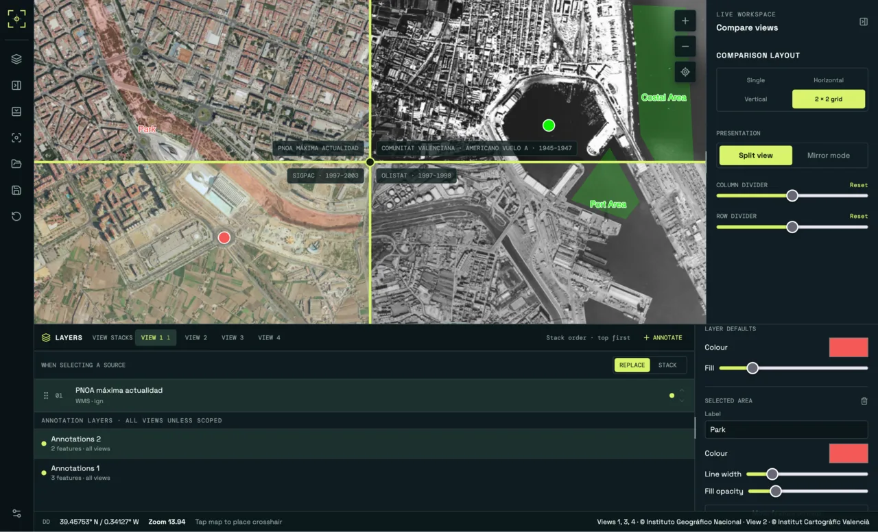
Atlas brings together historical aerial photography and official geographic data from across Spain. It lets you compare the same location across different years, whether you are following the expansion of a neighbourhood or looking at changes along the coast.
Finding the imagery
Spain has a considerable amount of public geospatial data, but finding it and working out what is available for a particular location takes some effort. National and regional providers maintain separate catalogues, with different service formats and gaps in coverage. A layer appearing in a catalogue doesn’t necessarily mean the service behind it is still working.
I built a Go API to validate and catalogue WMS, WMTS, XYZ and ArcGIS services before making them available in the application. PostgreSQL with PostGIS handles the geographic queries, while the map interface is built with Vue, TypeScript and MapLibre.
Comparing maps
The timeline brings the different imagery campaigns together so you don’t need to work through each provider’s catalogue separately. Comparison views stay at the same position, zoom level and source, date and coverage information is available alongside the imagery. Coverage is particularly important here: the available years can vary considerably from one area to another.
Alongside the photographs, Atlas supports raster and vector layers, annual coverage overlays and annotations with workspaces saved locally. The next step is a presentation editor for assembling layers, viewpoints and notes into something that can be shared.
The explorer and comparison tools are live at atlas.invoate.com.